“Tunnel Guide” Feature for GPS-Aided INS Improves Performance During GNSS Outage

Posted by Will Dillingham on Jul 27, 2020 10:08:58 AM

Defining the Problem

For years Inertial Labs has produced high accuracy Inertial Navigation Systems (INS) at the world’s best price-performance ratio. An INS estimates the position, attitude, and velocity using the gyroscopes and accelerometers contained inside an inertial measurement unit (IMU). Position accuracy can be greatly improved when the INS is aided by Global Navigation Satellite System (GNSS). However, GNSS is not always available. Customer requirements demand for better performance of an INS during a GNSS outage. Outages can be caused by tunnels, urban canyons, roads under bridges, etc. 

Read More

Topics: Motion Capture, GPS Denied Navigation, GPS-Aided Navigation, Stabilization, Aiming, Pointing, Surveying, Mapping, Navigation

Marine Navigation and the Development of the Motion Reference Unit

Posted by Will Dillingham on Jun 18, 2020 3:22:54 PM

History of Marine Navigation

                The Stars

Early sea-fairing explorers utilized the stars as their navigational aid. Celestial navigation, or otherwise known as astronavigation utilized devices such as the gnomon, Kamal, sea astrolabe, quadrant, cross-staff, back-staff and sextant.

               Magnetic Compass

Dating back as early as 200 BCE in China during the reign of the Qin dynasty, the Chinese originally used magnetism to construct fortune-telling boards, which turned out to be used for following directions in more than one way (1). Early magnetic compasses began to be commonly used as navigation aids in the 11th century.

Read More

Topics: GPS Denied Navigation, GPS-Aided Navigation, Navigation, Marine, History

Direct Georeferencing for Photogrammetry Using Inertial Labs INS-B

Posted by Will Dillingham on Mar 27, 2020 10:30:00 AM

Aerial Photogrammetry

Aerial Photogrammetric analysis may be applied to a single image or high-speed imagery and remote sensing to detect, measure and record complex  3D motion fields. This is done by feeding measurements and image analysis into computational models that estimate the relative motions and positions with increasing accuracy. While in its early days it was used mostly for topographic mapping, it’s application base has recently expanded into numerous industries. Modern sensors and software capabilities allow for the creation of precise 3D renderings and point cloud generation which is widely used in industries such as Filming, Sports, Game Development, Agriculture, Real Estate, Forensics, Land Surveying, and in Civil or Architectural Engineering. For these different applications, two methods of photogrammetry are used in practice today, Aerial Triangulation (AT), and a more modern approach, Direct Georeferencing.

Read More

Topics: GPS-Aided Navigation, Mapping, Navigation, UAV, Photogrammetry

The MRU-PD: A Motion, Heading and Position Sensor for Marine Applications

Posted by Will Dillingham on Mar 16, 2020 5:19:29 PM

Hydrography and Bathymetry

Bathymetric or Hydrographic surveys are survey methods used for submarine topography that have been implemented for observation of marine landscapes and structures for several decades. With the technology for executing a survey becoming more affordable, many businesses which can benefit from such data begin to pursue the proper equipment to use for themselves. Most users have a common goal of being environmentally aware of changes occurring due to the interaction with nature. Studying these changes usually involves measuring physical and chemical features of a body of water; or generating a 3D map of an underwater landscape/structure, to show its current state, or how it changes over time. A few examples of these survey methods being put into practice are:

  • Floodplain analysis
  • Dock maintenance
  • Seafloor tectonic interpretation
  • Submarine life conservation
  • Submarine natural resources deposit investigations
Read More

Topics: Surveying, Navigation, Marine, Dynamic Positioning

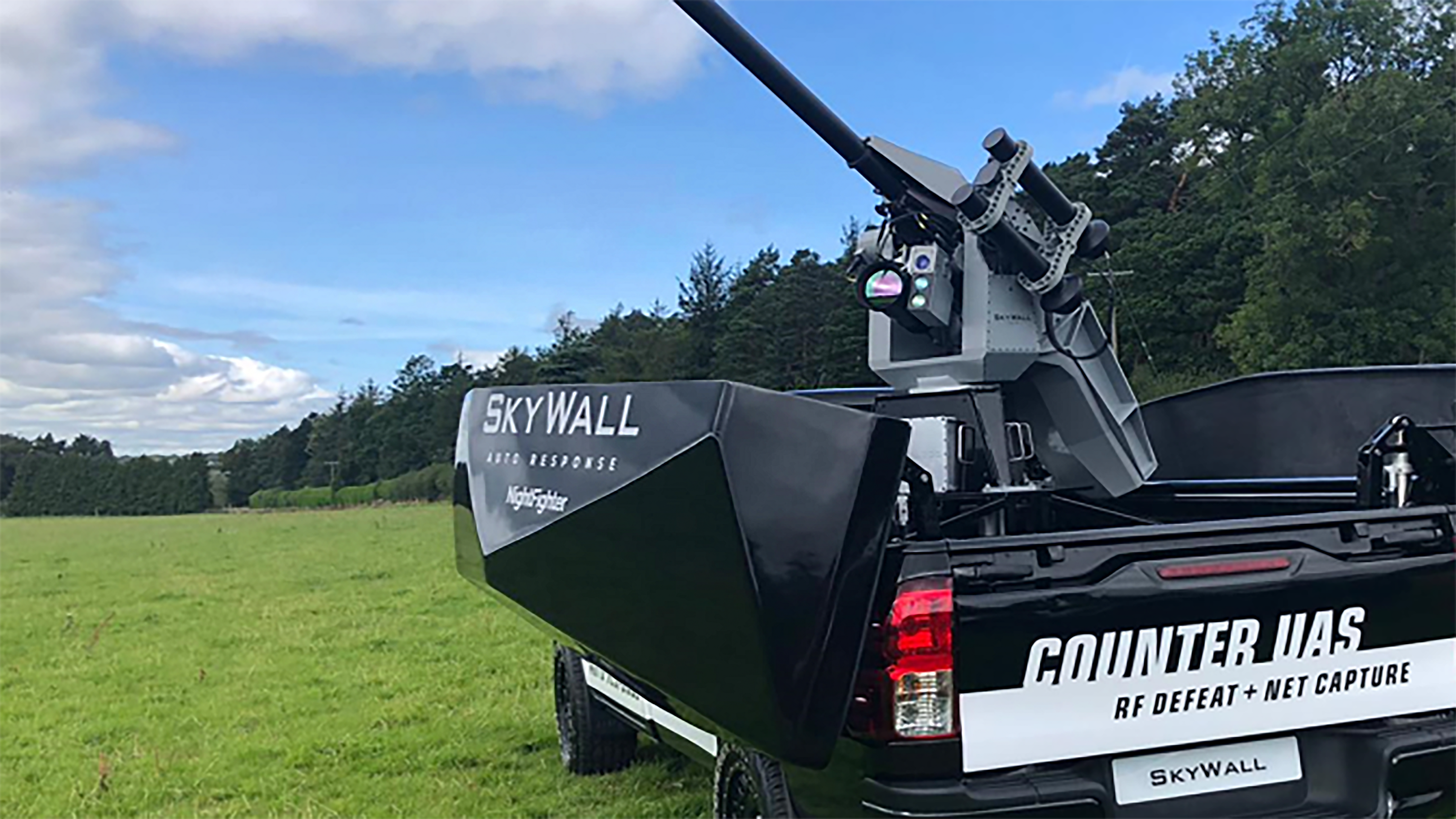
Counter UAS Upgrades for Better Accuracy in Dynamic Applications

Posted by Will Dillingham on Mar 16, 2020 2:53:57 PM

Protection

Since there initiation into the market in 2015, OpenWorks Engineering has been seeking to revolutionize the industry of security. While many industries focus primarily on offensive strategies for Autonomous Unmanned Systems (AUS) protection, OpenWorks has pushed an innovative solution that revolutionizes the defensive playing field. In the beginning of 2018, Openworks began it's partnership with Inertial Labs and entered testing phases for it's most successful product line, SkyWall.


Read More

Topics: GPS-Aided Navigation, Stabilization, Aiming, Pointing, Navigation, UAV


Inertial Labs Inc.

Solutions for all PNT Applications

Established in 2001, Inertial Labs is a leader in position and orientation technologies for commercial, industrial, aerospace and defense applications. Inertial Labs has a worldwide distributor and representative network covering 20+ countries across 6 continents and a standard product line spanning from Inertial Measurement Units (IMU) to GPS-Aided Inertial Navigation Systems (INS). With application breadth on Land, Air, and Sea; Inertial Labs covers the gambit of inertial technologies and solutions.

What makes us different:

Subscribe Here!

Recent Posts