Attitude and Heading Reference System (AHRS) Supports Data Input From External Single or Dual GNSS Receiver

Posted by Will Dillingham on Mar 20, 2020 5:45:00 AM

Value Added AHRS

Since its first release, the Inertial Labs Attitude and Heading Reference System (AHRS) has continued to develop and improve in its performance as well as its integration abilities. The newest addition, the AHRS-II-P, is a compact, lightweight, and affordable solution both as a standalone reference unit or a solution where applications involving the integration of an external compass or GNSS receiver may be needed to improve an existing system. Although the AHRS-II-P comes standard with an embedded fluxgate magnetometer to determine accurate Heading, input is supported for an external magnetic compass to increase static and dynamic accuracy. The AHRS-II-P offers advantages over its competitors present on the market by recording and transmitting very accurate Heading, Pitch and Roll; a very appealing choice for applications involving motion control such as UAV’s, aircrafts, ships, or robotic devices.

Read More

Topics: Stabilization, Aiming, Pointing, orientation

How the Inertial Labs Kernel Tilt Sensors are Shaping Construction Safety

Posted by Will Dillingham on Mar 17, 2020 10:14:04 AM

The Price of Safety

As of today, the leading cause of fatalities and injury in the construction industry is due to a falling related incident. Data that was gathered by the United States Department of Labor and published by the Occupational Health and Safety Administration (OSHA) found that in 2017, falling incidents alone contributed to 39.2% of the total construction tragedies(1). But how do these incidents happen?

Much of the conventionally used construction equipment is designed to safely extend a worker as far as possible in order to allow them to operate in difficult to reach places that current automated processes are not capable of doing. These working platforms are called Mobile Elevated Work Platforms (MEWPs). Although effective by design for accomplishing work, these machines, when used improperly, can become dangerous. Below are a few examples of commonly used equipment where risk of injury is much higher.

Read More

Topics: Stabilization, Pointing, orientation, Industrial

The MRU-PD: A Motion, Heading and Position Sensor for Marine Applications

Posted by Will Dillingham on Mar 16, 2020 5:19:29 PM

Hydrography and Bathymetry

Bathymetric or Hydrographic surveys are survey methods used for submarine topography that have been implemented for observation of marine landscapes and structures for several decades. With the technology for executing a survey becoming more affordable, many businesses which can benefit from such data begin to pursue the proper equipment to use for themselves. Most users have a common goal of being environmentally aware of changes occurring due to the interaction with nature. Studying these changes usually involves measuring physical and chemical features of a body of water; or generating a 3D map of an underwater landscape/structure, to show its current state, or how it changes over time. A few examples of these survey methods being put into practice are:

  • Floodplain analysis
  • Dock maintenance
  • Seafloor tectonic interpretation
  • Submarine life conservation
  • Submarine natural resources deposit investigations
Read More

Topics: Surveying, Navigation, Marine, Dynamic Positioning

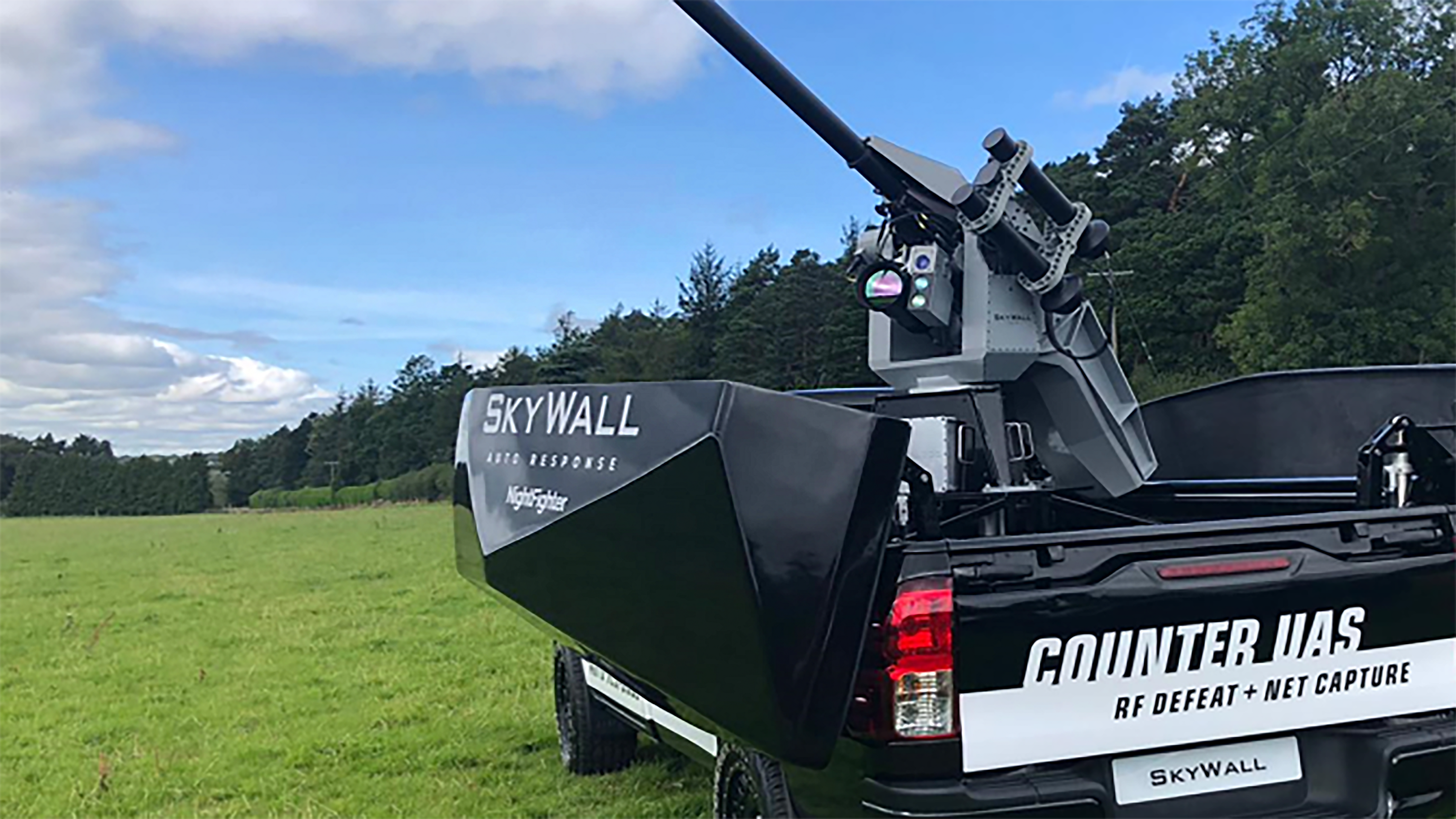
Counter UAS Upgrades for Better Accuracy in Dynamic Applications

Posted by Will Dillingham on Mar 16, 2020 2:53:57 PM

Protection

Since there initiation into the market in 2015, OpenWorks Engineering has been seeking to revolutionize the industry of security. While many industries focus primarily on offensive strategies for Autonomous Unmanned Systems (AUS) protection, OpenWorks has pushed an innovative solution that revolutionizes the defensive playing field. In the beginning of 2018, Openworks began it's partnership with Inertial Labs and entered testing phases for it's most successful product line, SkyWall.


Read More

Topics: GPS-Aided Navigation, Stabilization, Aiming, Pointing, Navigation, UAV

Embention Partners with Inertial Labs to Supply Complete Autopilot Payload Solution

Posted by Will Dillingham on Mar 13, 2020 2:11:41 PM

Partnership

Embention began investigating Inertial Labs as a supplier for inertial measurement units (IMU) or attitude and heading reference systems (AHRS) in 2013. Their developing project would involve integrating such sensors with targeted munition rounds specifically designed for controlling and mitigating forest fires.

In subsequent years, the Inertial Labs Inertial Navigation System became an appealing GPS-Denied navigation solution for Embention, who started discussing an integration with the Veronte Autopilot (produced by Embention) in 2016. Inertial Labs is delighted to announce the successful completion of integration efforts on November 26, 2019 when the INS-P, the professional version of the INS, was declared fully integrated and validated through testing.

Read More

Topics: GPS Denied Navigation, GPS-Aided Navigation, Surveying, Navigation


Inertial Labs Inc.

Solutions for all PNT Applications

Established in 2001, Inertial Labs is a leader in position and orientation technologies for commercial, industrial, aerospace and defense applications. Inertial Labs has a worldwide distributor and representative network covering 20+ countries across 6 continents and a standard product line spanning from Inertial Measurement Units (IMU) to GPS-Aided Inertial Navigation Systems (INS). With application breadth on Land, Air, and Sea; Inertial Labs covers the gambit of inertial technologies and solutions.

What makes us different:

Subscribe Here!

Recent Posts